
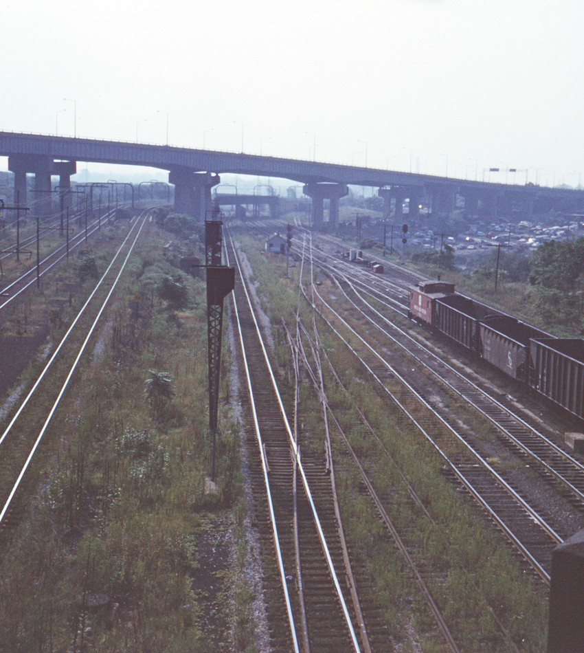
Another look at "puzzle switches" on the Nickel Plate's east Cleveland mainline, clearly showing the layout of the junction. (See the previous slide for an explanation of their purpose.) The Nickel Plate (now Norfolk & Western) is at right, with the connecting line coming from the upper right and connecting with the Erie's East 55th Street Yard. The destination of the connecting line seems to be the one remaining active Cleveland Union Terminal track, with a second barely visible in the weeds. To the left of the CUT trackage is the Erie's passenger connection, which has come over the nearest of the bridges in the distance and will connect with the CUT line behind the photographer. The Cleveland Rapid Transit's tracks to the eastern part of the city are at the far left. Again, this shot is taken from the Ohio State Route 43 overpass looking southeast.
